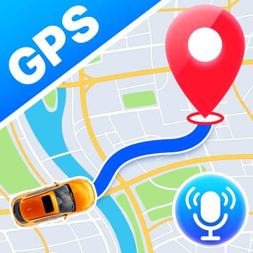
Satellite View - Maps - Radar
Advertisement
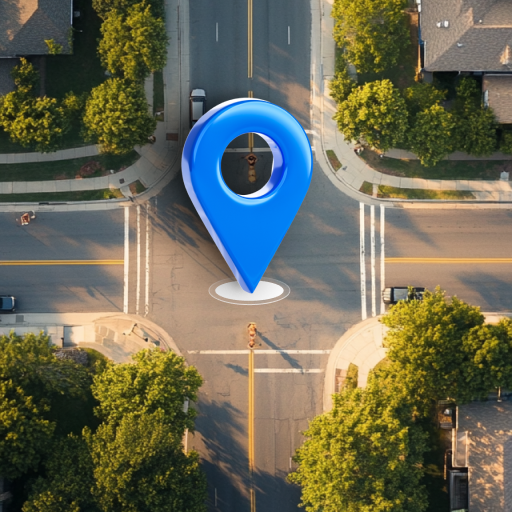
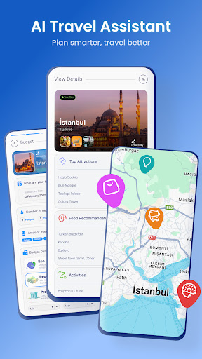
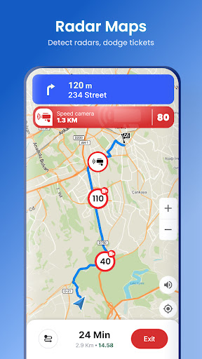
Screenshots


Advertisement
About Satellite View - Maps - Radar
Satellite View is a navigation software that brings you real-time satellite images and detailed map views. This Android application interface is quite intuitive and has rich functions, making your travel and exploration more convenient. Whether you want accurate positioning or want to see an aerial view above, Satellite View is a trustworthy helper that meets all your map needs.
Overview
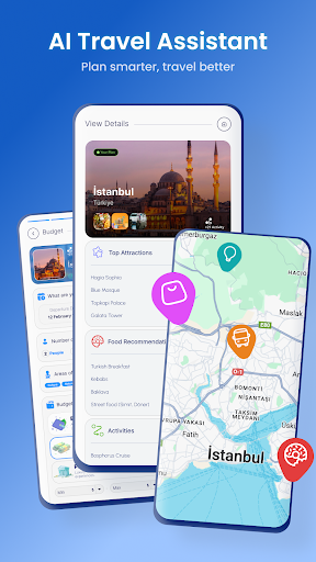
core functions
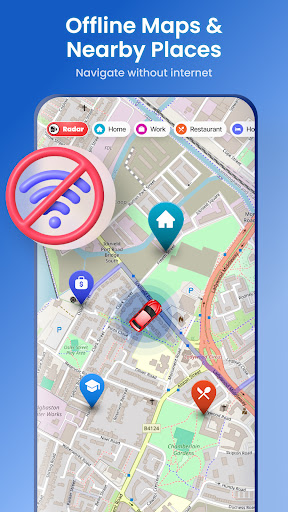
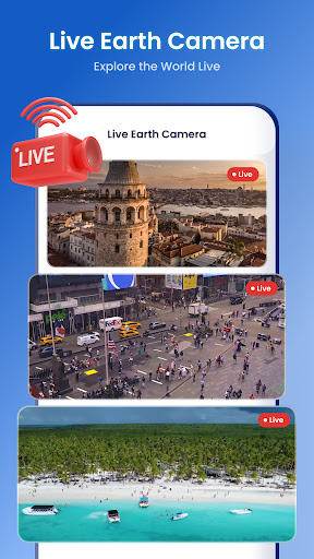
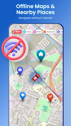
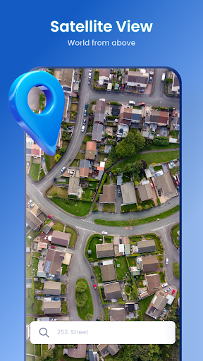
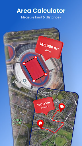
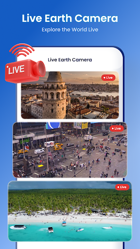
- This app provides ultra-detailed satellite images that allow you to see high-definition, ultra-accurate real-time maps, taking you directly into another perspective.
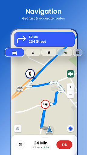
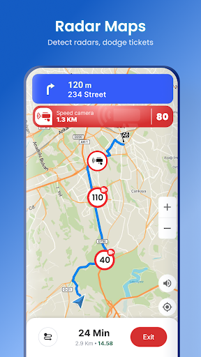
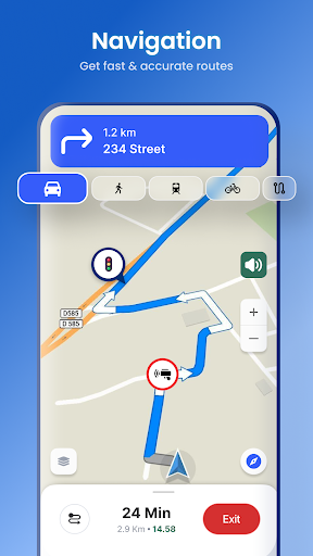
- The built-in GPS navigation function helps you easily plan your route and track your location in real time, so you can see it at a glance no matter where you go.
- Support offline mode, even if there is no network, you can open maps and satellite images at any time, and you can see them clearly without pressure.
- The interface is designed to be simple and intuitive, so whether you are a novice or an old driver, you can easily operate it without any trouble.
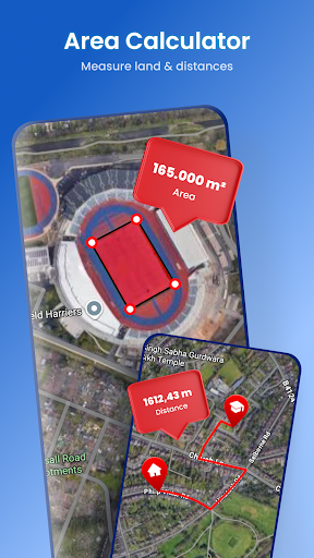
- Distance and area can also be measured directly on a map, making it convenient for your trip planning and better control everything.
- Regular updates make maps more accurate, and new geographical information is added to make the entire experience better and better.
- This Android app can also be used as a quick launcher to quickly open maps and navigation tools, which is super convenient!
Who is suitable for using this APP
This mobile app is especially suitable for outdoor sports buddies, travel enthusiasts, or those who need accurate maps for work. It works perfectly on Android, helping you with complex navigation tasks.
Whether you are preparing to climb mountains, visit strange cities, or dispatch logistics, you can experience the convenience brought by this multi-functional APP, a true one-stop navigation assistant!
Why choose this APP
What makes this Android app outstanding is that it combines detailed satellite views with intuitive and easy-to-use features to make route planning and real-time location tracking particularly smooth.
It focuses on reliability, is simple to operate, and provides a comprehensive navigation experience. It is definitely a smart choice, especially when it competes with other launchers and map tools!
Top Recommended Alternative
Pros & Cons
Pros
- high-resolution satellite imagery
- The operating interface is simple and easy to use
- updated in real time
- wide coverage
- Multi-layered maps and tools
Cons
- Free features are limited
- Not convenient to use offline
- Slow loading in large areas
- Occasionally, data lags or inaccurate
- Basic version has less personalization
Advertisement
Download Satellite View - Maps - Radar

FAQ
Is Satellite View a safe and reliable app to install on my Android device?+
How do I install Satellite View on my Android device?+
What features does Satellite View offer for navigation enthusiasts?+
Can I use Satellite View offline, or does it require an internet connection?+
Is Satellite View compatible with both Android and iOS devices?+
You Might Also Like
More apps you may want to try next.