Live Satellite View: GPS Map
Advertisement
Screenshots
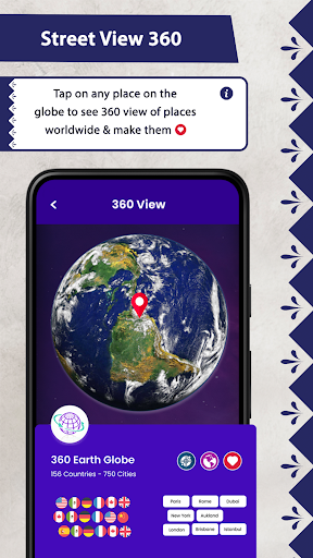
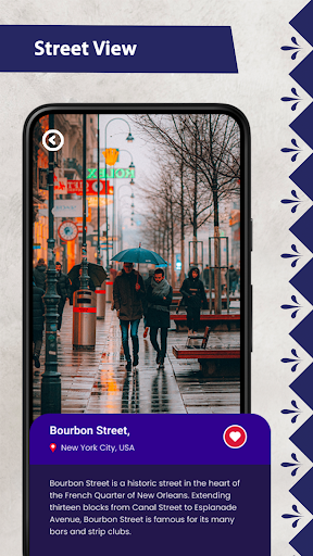
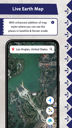
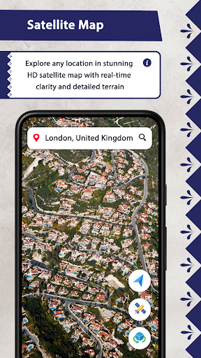

Advertisement
About Live Satellite View: GPS Map
Overview
core feature
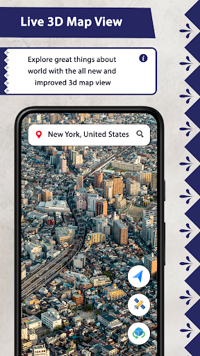
- Real-time satellite views can give you the most accurate and up-to-date aerial images, which are super reliable whether it is navigation or adventure.
- Easy-to-operate application functions, such as zoom in, tilt, and rotate, make your viewing experience more personalized and comfortable.
- It is also equipped with practical route planning tools with real-time traffic information to help you plan travel routes more efficiently.
- High-definition images are particularly clear and rich in details, suitable for outdoor activities or making maps.
- Offline mode can also be used. Saved satellite pictures can be retrieved at any time and can be viewed without the Internet. It's a very thoughtful design.
- The speedometer and street view function enhance the overall feeling and save trouble when traveling and exploring.
Who is suitable for?
This APP is especially suitable for people who like outdoors, love travel, or need reliable navigation. If you want to use an Android app with detailed maps and rich real-time data, it can really help you improve your outdoor adventure and daily commuting experience.
Whether you're planning to climb mountains, discover new places, or need a reliable navigation app that likes to experience satellites and maps perfectly without worrying about signals, this app can meet your needs and turn your mobile phone into the best travel assistant.
Why choose this App
What makes this Android app attractive is that it is comprehensive and combines real satellite images with real-time updates, making it super practical. It is convenient and reliable to use, helping you easily complete navigation and outdoor plans.
I chose it because I took a fancy to its intuitive, trustworthy and trustworthy design, which meets the various needs of modern users for navigation and maps. It is better than many others on the market. It is definitely a good choice.
Top Recommended Alternative
Pros & Cons
Pros
-
high-resolution satellite images
-
Real-time dynamic updates
-
The interface is very friendly
-
Global coverage
-
Basic functions are free
Cons
-
Limited amplification in some areas
-
Real-time updates will be a little delayed
-
Slow response when switching views or scrolling
-
The free version cannot view historical images
-
Occasionally it crashes on old equipment
Advertisement
Download Live Satellite View: GPS Map
FAQ
Can I use Live Satellite View? Was it difficult to try it for the first time? +
Of course, Live Satellite View is specially designed for novices. The interface is super friendly and it is super fast to get started! The simple layout allows you to easily handle various functions, whether it is Android or other platforms, and it will run smoothly.
The user experience is also quite smooth, and you can quickly browse satellite images and street views. Even if you don't know anything about map navigation, this software will make you feel very natural, considerate, and without any pressure at all!
Are the satellite images of Live Satellite View accurate? +
Of course! The satellite images provided by this application are truly accurate and can definitely be used as a reliable Earth observation tool. Many people are using it to check maps and find street views. It is spread all over the world and is very reliable.
This Android software can also be updated in real time, and the images are also very delicate. Whether you are watching Street View or satellite images, you can use it with confidence. The data is very accurate and it can help you navigate or explore without any problem.
Can I use Live Satellite View offline? +
At present, it mainly needs to be connected to the Internet to load real-time images and maps, but some things may be able to save certain views in advance and quickly view them later. It can be regarded as a little offline function.
If you care about offline use, it is recommended to pay attention to its latest version or settings. Many map navigation software are constantly improving offline capabilities, which may be more convenient in the future, and it will become more and more convenient for travel and exploration.
Is it dangerous to use Live Satellite View on an Android phone? +
Don't worry at all, this software is absolutely safe and reliable, and especially respects user privacy and data security. It can be found on the Google Play Store, and many users have given it good reviews and a trustworthy choice.
The software follows various security measures to ensure that your personal information is not leaked. To find a reliable navigation extension tool, Live Satellite View is a good choice and guaranteed!
What are the main functions of Live Satellite View? +
The main functions include real-time satellite images, street views, distance measurement tools, and even speed detectors that can help you track your moving distance. These functions are combined to form a complete Android map and navigation software.
The interface design is also very intuitive, making it very convenient to explore different places. Whether it's planning a route or just wanting to see satellite images, Live Satellite View can satisfy you, let you enjoy it, and is very functional!
Customer Reviews
Users generally appreciate the app's potential for accurate satellite views and its usefulness, with many calling it excellent or great. However, the overwhelming number of advertisements is a major complaint, disrupting the user experience—though some acknowledge ads support free access. Regarding accuracy, while some find it wonderful when the view is true, others report that the satellite imagery is not live or up to date. Performance is praised for fast download, yet criticized for sluggish interface, poor zoom clarity, and occasional non-functionality. Additionally, users dislike forced ratings upon first opening. Overall, the app has both strong advocates and strong detractors.
Write a Review
Share your experience with Live Satellite View: GPS Map. Submissions are reviewed before publishing.
You Might Also Like
More apps you may want to try next.