FamiliarApps logo
US Public Lands

US Public Lands

Advertisement

Screenshots
10 images
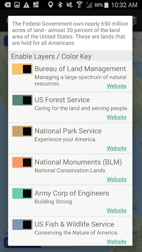
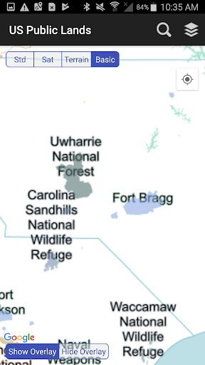
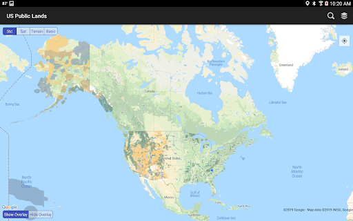
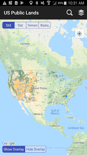
US Public Lands screenshot 1 US Public Lands screenshot 2 US Public Lands screenshot 3 US Public Lands screenshot 4 US Public Lands screenshot 5 US Public Lands screenshot 6 US Public Lands screenshot 7 US Public Lands screenshot 8 US Public Lands screenshot 9 US Public Lands screenshot 10

Advertisement

About US Public Lands

The US Public Lands app is really tailored for those who like to be outdoors and travel. It is particularly convenient to use on mobile phones, and the interface is quite simple, making it easy for anyone to use. It contains detailed information about various national parks, forests and so on across the country, so that you can plan your trip without worrying about taking the wrong way. There are also maps, hiking paths, entrances, etc. It feels like having a considerate guide, making outdoor adventures easier and more interesting, so that even novices can play with confidence!

Overview

core functions

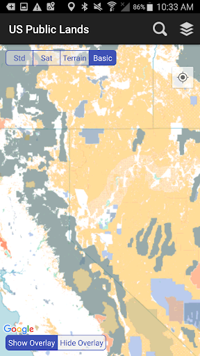
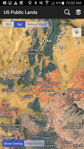
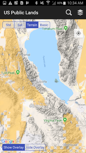
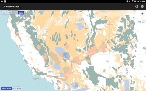
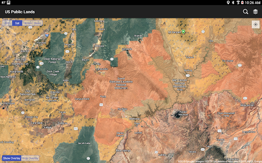
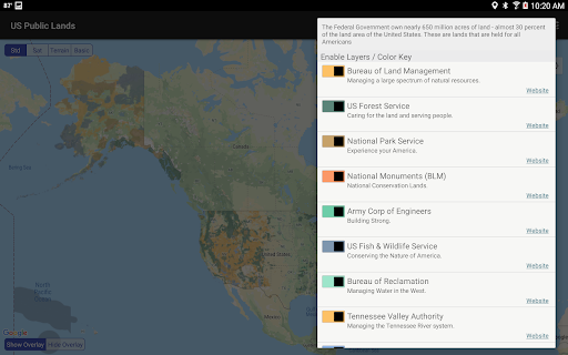
  • This app helps you find detailed maps of various public lands, supports zooming and searching, making navigation much easier. It's really sweet!
  • It also provides information about land boundaries, entrance locations, ownership, etc., all to make you more comfortable planning your trip.
  • Using real-time GPS tracking, you can smoothly control your position while playing outdoors without getting lost or going astray.
  • Offline mode is really great. You can read maps and check data without using the Internet, and you can use it smoothly in remote areas.
  • There are also some carefully organized tips for camping, hiking and outdoor leisure to give you more protection and less trouble.
  • You can also receive notices about land rules and regulations and the latest developments, so that you can always keep up with the latest information and comply with the regulations with peace of mind.
  • This APP is tailor-made for outdoor enthusiasts and travelers. The whole experience is super close to actual needs and is really like!

Who is this app suitable for?

For people who like to be outdoors, hiking, hunting, and camping, this software is simply a tailor-made assistant. When exploring public land every day, this app can help you get rid of a lot of trouble.

Whether preparing for a weekend trip or wanting detailed land information to ensure safety and navigation, it is basically an ideal choice for responsible explorers who like to easily do outdoor things on their mobile phones.

Why choose this APP?

This Android app is particularly easy to use, has a friendly interface and reliable functions, making outdoor navigation easy and enjoyable. What a "worry-saving artifact"!

It provides accurate maps, real-time data and offline features that make it easy to use even in remote areas. All kinds of functions come together, specially designed for public land exploration and leisure planning, really super practical!

Top Recommended Alternative
Pros & Cons

Pros

  • A super-wide public land map
  • The interface is super friendly and easy to use
  • Maps and guides can also be used offline
  • Including detailed information on camping and hiking
  • The latest public land information is regularly updated

Cons

  • Too few social sharing features
  • GPS is sometimes inaccurate in dense forest areas
  • Information on some parks with few people is pitifully scarce
  • The filtering of the search function needs to be enhanced
  • Occasionally it crashes when upgrading

Advertisement

Download US Public Lands

You are going to be redirected to the official website to finish the download when you click these buttons above.

FAQ

How do I log into the US Public Lands app? +
Logging in to a mobile App on public lands in the United States is actually very simple. Just open the App and click the login button. You can log in with your email account, or you can connect with one click through your social media account, which is super convenient. This App has a smooth experience and is specially designed for outdoor enthusiasts! It doesn't matter if you haven't registered an account yet. Registration will take a few seconds. It also comes with personalized maps and real-time updates, making exploring public land safe and efficient. I sincerely recommend it!
Is the US Public Lands app safe to use on Android devices? +
Of course, this Android APP on American public lands was developed by a trusted organization and regularly pushes security updates. The design takes user security into account to ensure that your information and data are protected. Remember to download it from official channels and keep the latest version of your devices and apps so that the experience will be smoother and safer. Use it with confidence!
Can I use the US Public Lands app offline? +
Absolutely! The App has offline maps that allow you to explore and plan your outdoor trips without the Internet. Especially suitable for use in remote areas with poor signal. In order to use it more smoothly, it is best to download relevant data in advance when you have Wi-Fi, so that you can rely on offline data even in remote areas, which is quite convenient!
What are the main features of the US Public Lands app? +
This American public land App is quite rich in features, such as detailed maps of national parks and land, trail information, and land management information. It helps outdoor activity enthusiasts plan in advance and navigate safely. The user experience is very intuitive and you can keep up with the latest information in real time. The map can also be customized. It is definitely a good helper for outdoor adventure and can be used no matter where you are in the United States!
Does this app provide information about different types of public lands? +
Of course there is! It contains detailed information on various public lands such as national parks, forests, wildlife reserves, etc., and is an authoritative source of land information. With this App, you can easily find the latest land boundaries, relevant regulations, and points of interest, making your outdoor plans safer and smoother. How sweet!
Can I access US Public Lands on my Apple device too? +
Yes! Apps on public lands in the United States also have versions on iOS devices and can be found directly in the Apple App Store. The operation is as smooth as the Android version, and the functions are similar. It can be used by friends who go out for hiking outdoors. Whether you use an iPhone or iPad, this App helps you easily explore public land and play with peace of mind. Detailed maps and land information give you more confidence!
How reliable is the app in providing updated land information? +
This App is maintained in a timely manner, and the data from the Land Management Bureau is up-to-date to ensure that the information provided is accurate. Many functions can also be updated in real time to help you plan in advance and avoid stepping on lightning. Real and reliable data on intercom is really important, which makes it a reliable helper for outdoor enthusiasts. It is safe, accurate and worth relying on!
Do I need any special permissions to use the US Public Lands app? +
Under normal circumstances, you don't need special permissions to use basic maps and location detection functions, but if you want to use offline maps or share locations, you have to authorize the corresponding permissions. Remember to check the permissions settings. It not only protects your privacy, but also makes the App's functions more complete, so that you can have fun and rest assured!

Customer Reviews

AI
AI Generated Summary
Based on real user feedback
★ 3.5

Users highly value the app's offline functionality, which reliably displays public land boundaries for camping and boondocking without cell service. Many find it useful for locating BLM and USFS lands. However, opinions on accuracy are sharply divided: while some report perfect boundary data and no errors, others experience severe inaccuracies—private land mislabeled as public, borders off by up to half a mile, and even missing or incorrect areas. Feature requests are common: users want the ability to tap layers for ownership info, export pin coordinates, and add GPS coordinate lookup. Some also note the lack of dark mode or a mile scale indicator. Despite these criticisms, the low price ($3) and seamless integration with Google Maps remain strong selling points.

A Google user · 2026-06-14
★ 1
Help! I just downloaded this app. The search feature doesn't work, and I can't find the option to enable real-time tracking of your location.
Markus Braun · 2026-06-13
★ 5
This tool is extremely useful for boondocking, offering reliable support for off-grid camping and self-contained travel.
A Google user · 2026-06-11
★ 1
I have the standard map enabled with all layers connected, but only the green National Forest layer appears. The base map shows nothing. Frustrating!
kimberly hawkins · 2026-06-11
★ 5
This is a very cool app that helps you determine whether you are on public or private lands, making it easy to stay informed about your surroundings.
A Google user · 2026-06-07
★ 5
A highly useful item, particularly for those who enjoy boondocking. You'll find it to be a great addition to your setup.

Write a Review

Share your experience with US Public Lands. Submissions are reviewed before publishing.

Rating *
0 / 2000

You Might Also Like

More apps you may want to try next.

Advertisement
5
Please wait...