HuntStand: GPS Maps & Tools
Advertisement
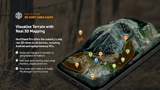
Screenshots
Advertisement
About HuntStand: GPS Maps & Tools
HuntStand: GPS Maps & Tools It's really a super all-around mobile app designed for those who like outdoors, hunting or need precise location. Whether you're using Android or Apple, this software can do it. It has detailed maps, GPS navigation anytime and anywhere, and of course some useful features for hunting and field planning. The interface is particularly friendly, intuitive and quick to use. The whole experience is like being immersive, making outdoor navigation and planning fast and cool!
Overview
core functions
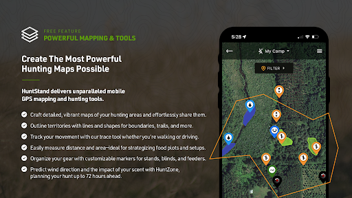
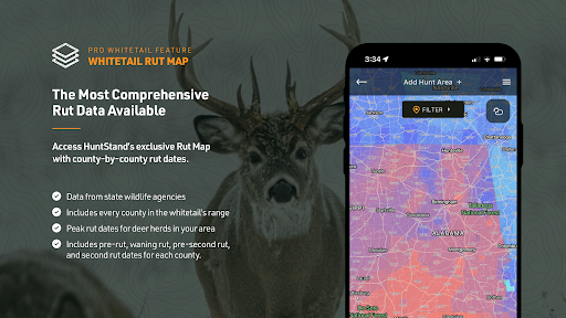
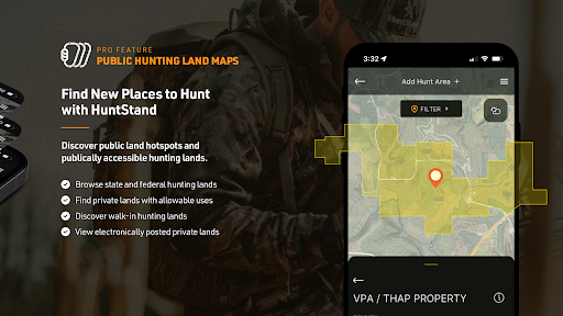
- Covering comprehensive GPS maps, detailing terrain and landowner boundaries, provide a great aid in planning hunting and outdoor activities, as if you can always find where you want to go.
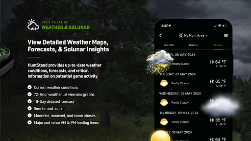
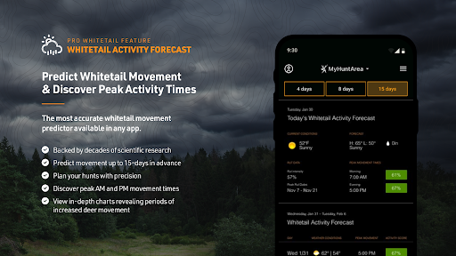
- With these advanced features including real-time weather changes, path tracking, and marking, Navigation becomes smoother, like having a caring assistant on the road.
- Moreover, this app can also be used offline. Even if there is no Internet, maps and data can be called up at any time. It's a very thoughtful design.
- The experience is very smooth, the interface design is intuitive, easy to operate, and quick to start. It is especially suitable for hunters and people who like outdoors.
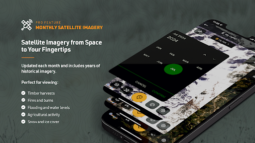
- It can also combine various map layers and data sources to make navigation more accurate and reliable. It feels like there is an invisible eye guiding you.
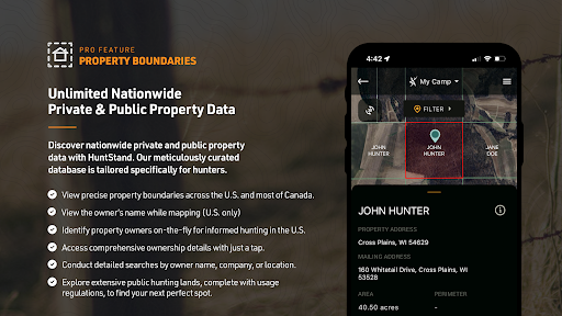
- It can customize the boundaries of land and property, help you plan your trip, and also make it convenient for you to understand the rights to use the land. It is really a very considerate and practical helper.
Who is this App suitable for?
This mobile app is especially suitable for experienced hunters, outdoor adventure fans, and land owners who need reliable navigation tools and land management functions. Android users will be particularly comfortable using it and feel that this is the outdoor planning artifact they have been looking for.
Whether it's tracking prey, tracking remote routes, or managing your own land boundaries, this app can help you get things done, allowing you to stay organized, feel safe and have more fun in complex terrains.
Why choose this App?
This Android app is super friendly to use and powerful. It is specially designed for outdoor enthusiasts. Its accurate maps and real-time updates can greatly improve your navigation level and decision-making speed. It feels like you have an extra pair of discerning eyes to help you.
It emphasizes reliability and is easy to operate, making it a good choice for those who need trustworthy outdoor navigation and land management tools. The various functions are richer than many similar apps, and the experience is great. I truly recommend it!
Top Recommended Alternative

Pros & Cons
Pros
- Accurate GPS mapping and real-time positioning tracking
- Large number of offline map downloads
- Comprehensive exclusive hunting gear
- Friendly interface, map layers can be customized
- Additional features, such as weather forecasts and sunset times, help you plan ahead
Cons
- Free features are limited, subscription system is adopted
- Sometimes map loading can be a little delayed in dense forests
- Long-term use will cost more electricity
- There are no convenient sharing locations or tagging features
- Some older devices experience crash problems
Advertisement
Download HuntStand: GPS Maps & Tools


FAQ
Is HuntStand a safe app to use on my mobile device?+
How do I create an account or log in to HuntStand?+
What are the main features of HuntStand that make it worth using?+
Can I use HuntStand on my Android device, and is it available as a launcher app?+
Does HuntStand offer offline map access for remote areas?+
You Might Also Like
More apps you may want to try next.