Earth Map Satellite Live View
Advertisement
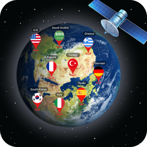
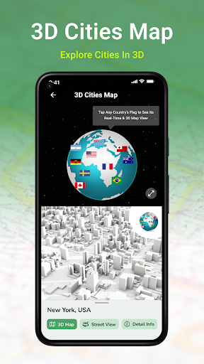
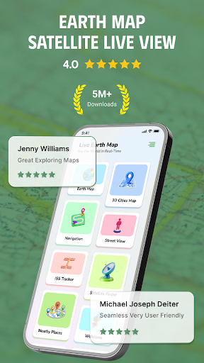
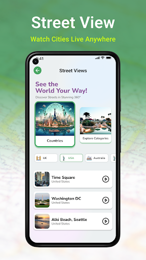
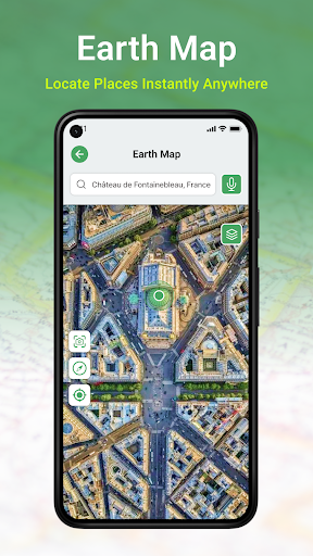
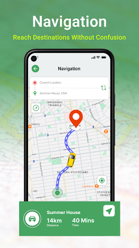
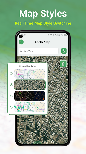
Screenshots
Advertisement
About Earth Map Satellite Live View
Earth Map Satellite Live View is a great app, especially suitable for friends who like to travel and explore. It can provide ultra-detailed satellite images and display the earth's conditions in real time, making you feel like you are there, and you can "travel" all over the world anytime, anywhere. As an Android application that is very easy to operate, its map functions are particularly rich. Coupled with real-time satellite data updates, it is always surprising. Whether it is used to make travel guides, learn geography knowledge, or simply to satisfy curiosity, this app can bring a lot of help. It is really a good helper for travel and study!
Overview
Core Features
- Those high-resolution satellite images can vividly show almost every detail on the earth, making it very interesting when exploring.
- Real-time live screen updates, you can see the latest weather conditions or geographical changes anytime and anywhere, which is so convenient!
- Offline mode allows you to view saved maps and satellite pictures when you are off the Internet. It's very considerate and easy to use.
- The operation is intuitive, navigation easily helps you find your way to explore different places, and everything becomes simple and interesting with satellite coverage.
- Advanced features also include route planning and distance measurement, making maps more accurate and adding points to travel and planning.
- Perfectly combined with the device's GPS to ensure that your location tracking is accurate and the experience is smoother and more secure.
- You can also customize and choose different map types and satellite layers to make your browsing experience more intimate and personalized.
Who This App Is For
This app is especially suitable for friends who like outdoor adventure and travel, as well as professionals such as geographers and urban planners who need detailed views of the earth and navigation tools.
Whether you want to explore new places, plan routes, or conduct field inspections, this app can help you use satellite imagery and map functions to get it done anytime, anywhere, and is very reliable.
Why Choose This App
The reason why this Android app stands out is that its satellite images are highly clear and updated quickly, which can give you a great visual experience, especially suitable for users who are pursuing details.
The interface is simple and easy to use, and at the same time is powerful. It can not only meet personal needs, but also suitable for professionals. It is undoubtedly a trustworthy choice.
Top Recommended Alternative

Pros & Cons
Pros
- High-definition real-time satellite images
- simple interface to
- updated in real time
- global coverage
- Additional map tools
Cons
- Limited free high-resolution images
- Sometimes some areas get stuck or load slowly
- It will burn electricity if you use it for a long time
- Limited historical images
- Some functions need to be connected to the Internet to be used
Advertisement
Download Earth Map Satellite Live View

FAQ
How do I get started with Earth Map Satellite Live View?+
It's actually quite simple to start using Earth Map Satellite Live View. Once you install this mobile app, you can easily work out its various functions and see real-time satellite views of the earth anytime and anywhere. The interface is particularly intuitive, so that even first-time users can get started quickly and won't be confused.
Whether you're using an Android app or chtyobox, or looking for a launcher with map navigation, Earth Map Satellite Live View will give you a smooth experience. The design is very thoughtful and ensures that you can explore quickly and enjoy detailed satellite imagery without stress.
Is Earth Map Satellite Live View safe to use?+
Of course, Earth Map Satellite Live View is a very reliable and safe application, and privacy and everything are valued. Made by a professional development team, it meets security standards, not only ensures the security of your data, but also provides high-quality map functions.
You can use it with confidence. Whether you are exploring on your Android phone or using it to see the world, the satellite images are very accurate, the application is quite safe, and you have a sense of confidence. You can use it with confidence and you will be done.
What are the main features of Earth Map Satellite Live View?+
This app is full of highlights! There are real-time satellite maps, detailed maps, and the function of zooming in and out. Users especially like it to combine satellite imagery and navigation functions, which is especially suitable for exploring roads, planning itineraries, or where they want to see distant places.
Its characteristics are real-time view of the earth and accurate location tracking, making it the top choice in maps and navigation. Whether you use it on Android or want to find a multi-functional map launcher, it can bring you a rich experience. It is really a fun app worth recommending.
Can I use Earth Map Satellite Live View offline?+
The main functions still need to be connected to the Internet to be used, but some map functions can also be used offline after downloading specific satellite data. In this way, even if there is no stable network, you can explore those areas at any time, which is quite convenient.
However, the safest way to use all functions is to maintain a network connection. This app is particularly optimized to quickly provide detailed satellite images, allowing you to get a high-definition picture of the earth on Android devices, with a great experience.
How does Earth Map Satellite Live View compare to other mapping apps?+
The biggest feature of this application is its real-time satellite imagery and user-friendly interface, which makes people feel particularly fresh. Unlike other map applications, it places special emphasis on real-time satellite views, which is super helpful for outdoor adventure or geography learning.
Its functional design is very considerate and can display detailed pictures without complex operations. It is quite practical. As a navigation launcher or map tool, it performs well and is worth a try. Friends who like high-definition satellite images will definitely like this application.
Is Earth Map Satellite Live View suitable for all devices?+
This Android app is optimized for most modern smartphones and tablets and is smooth to use. High-resolution satellite images and smooth navigation functions are added, and the user experience is quite good.
If you are looking for a reliable map navigation application, Earth Map Satellite Live View performs well on different Android devices. Whether you are in a city or a remote place, you can see a detailed view of the earth to meet various exploration needs.
You Might Also Like
More apps you may want to try next.